Occupancy Uncertainty Maps
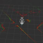
Most mobile robots for indoor use rely on 2D laser scanners for localization, mapping and navigation. These sensors, however, cannot detect transparent surfaces or measure the full occupancy of complex objects such as tables. We recently proposed a Deep Learning approach to overcome this limitation by learning to estimate object occupancy. These estimates are nevertheless subject to uncertainty, making the evaluation of their confidence an important issue for these measures to be useful for autonomous navigation and mapping.
In this project we research how to build maps which include the uncertainty of the robot over the occupancy of the objects in the environment.
We have shown how the constructed maps can be used to increase global navigation safety by planning trajectories which avoid areas of high uncertainty, enabling higher autonomy for mobile robots in indoor settings.

People involved
- Francesco Verdoja (francesco.verdoja@aalto.fi), postdoctoral researcher
- Jens Lundell (jens.lundell@aalto.fi), doctoral candidate
- Ville Kyrki (ville.kyrki@aalto.fi), professor
Project updates
Dataset for “Hallucinating Robots”
We released the dataset for our IROS 2018 paper “Hallucinating Robots: Inferring Obstacle Distances from Partial Laser Measurements”.
Source code for “Hallucinating Robots”
We released the code for our IROS 2018 paper “Hallucinating Robots: Inferring Obstacle Distances from Partial Laser Measurements”.